- Geographic Coordinates: 33 00 N, 65 00 E.
- Total Area: 652,230 sq km.
- Land Area: 652,230 sq km.
- Water Area: 0 sq km.
- Compared to the United States, Afghanistan is almost six times the size of Virginia, but slightly smaller than Texas.
- Afghanistan is ranked 41 compared to all of the other countries in size.
- Countries That Share a Border: China, Iran, Pakistan, Tajikistan, Turkmenistan, and Uzbekistan.
- Total Distance of All Land Boundaries: 5,987 km.
- Total Distance of Coastline: 0 km.
- Climate: Arid or semiarid. Afghanistan has cold winters and hot summers.
- Terrain: Mostly rugged mountains and has plains in the North and Southwest.
- Point of Lowest Elevation: Amu Darya, 258 m.
- Point of Highest Elevation: Noshak, 7,485 m.
- Natural Disasters: Afghanistan can have damaging earthquakes that occur in Hindu Kush mountains. Afghanistan can also have flooding and droughts.
- Environmental Issues: At the moment, Afghanistan has limited natural freshwater resources, along with inadequate supplies of potable water. Soil degradation, overgrazing, and deforestation (much of the remaining forests are being cut down for building materials and fuel) are also an environmental issue.
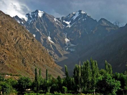
The Hindu Kush mountains.
|
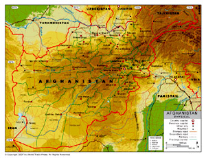
Physical map of Afghanistan.
|

Regional map of Afghanistan.
|
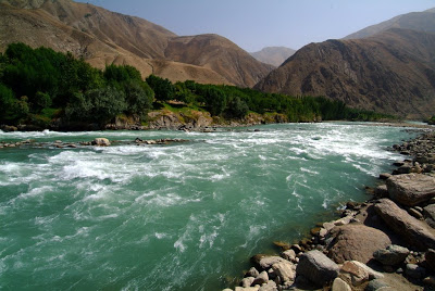
The Kokcha river.
|
Sources: The CIA World Factbook and Google Images.
